PENTWATER LAKE WATERSHED
The Pentwater Watershed is approximately 166 square miles in Oceana and Mason counties. About 22 percent of the watershed is composed of wetlands.
In November 2021 a group of 8 individuals formed the “Friends of the Pentwater River Watershed” to support conservation efforts in the watershed. In June 2023 the group became a committee of the Pentwater Lake Association to enable it to submit grant applications.
Please click link below to watch a narrated PowerPoint presentation of the North Branch of Pentwater River created by Rich Pugsley November 2021.
https://1drv.ms/p/s!AtrUiN0m2Yyqh2wj_GnDLtgVi-OG?e=L3oiUP
Below are two outlines of the Pentwater Lake Watershed.


Pentwater lake Watershed- outline
Watershed PROJECTS:
South Branch Watershed Management Plan – In 1999 a federal grant was awarded to the Oceana Conservation District to develop a comprehensive management plan for the South Branch of the Pentwater River.
CLICK LINK BELOW: SOUTH BRANCH WATERSHED MANAGEMENT PLAN
SOUTH BRANCH WATERSHED MANAGEMENT PLAN
1. Information Meetings – Since 2021 the “Friends” have had several information meetings to learn how to manage a watershed. Meetings were held with: Drain Commission, Road Commission, DNR, Trout Unlimited, EGLE Water Resources, ANNIS Water Resources Institute, Conservation District, West Michigan Regional Shoreline Development Commission and Oceana County Parks Commission. Minutes of these meetings are available.
2. Fish Surveys – In 2022 fish surveys were completed by Mark Tonello, DNR Fisheries Biologist, and team on both the South and North Branches. To quote Mark “The North Branch was one of the best fish surveys we have ever done.” The report has not yet been released.

3. Sandy Bend Project – During the summer of 2023 in cooperation with West Michigan Shoreline Regional Development Commission a 60% engineering study for a Sandy Bend restoration project was completed. There is now interest from NOAA in potentially funding the implementation in the next round of projects. Tours of Sandy Bend are available.
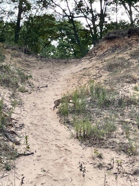
sandy bend erosion
4. Road/Stream Crossing Inventory – In the summer of 2023 a survey of all 290 road/stream crossings in the watershed was completed. The results are summarized in the following report. The locations and data at each location can be viewed on the Trout Unlimited RIVERS website. CLICK LINK BELOW for Inventory report:
5. EGLE Water Resource Division Tour – In July 2023 a tour was conducted with Hannah Arnett and Nathaniel Shuff from Environment, Great Lales, and Energy Water Resources Division. Hannah coordinates large water withdrawal permits and Nathaniel is a geologist who conducts assessments. The crossing inventory identified that 12% of the road/stream crossings identified in the 1990 USGS data are now dry. This created the question of whether water use was a problem. Hannah indicated that most, if not all, new permit requests were for wells and not river withdrawals. Linda Herremans from the Conservation District is copied on all new permit requests in the county. As a result of the tour the group came back two days later and tested flows in some of the tributaries. The results looked good and raised no concerns. The tour also allowed the group to establish good monitoring sites to use going forward to assure the watershed stays in good shape.
6. Trout Unlimited (TU) Tour - On August 2, 2023 a watershed tour was conducted with four representatives from Trout Unlimited and the Conservation District. The Trout Unlimited representatives were Jake Lemon, Monitoring and Community Science Manager for TU national currently working on the White River, Kristin Thomas, Michigan Stream Restoration Director, and Jordyn Stoll, Michigan Aquatic Biologist. Sky Harsh joined from the Conservation District. Their interests were to become familiar with the watershed, discuss potential future projects, and learn about dams in the watershed. They were impressed with the health of the watershed.
CLICK on LINK below for tour route:
7. Watershed Dam Inventory – In August 2023 a report was created showing the location of 17 dams in the watershed. See report below. Of the dams, 14 are private, one is owned by the City of Hart, and two are owned or partially owned by the county. Dam removal is a priority for TU because of the impact on water temperatures. Dam removal is a key imitative to reverse the effects of global warming. CLICK LINK below for August Inventory.
UPDATE January 2025 - please click Dam Inventory link below to see all 23 dams noted.
Dam Inventory in Pentwater Watershed: update January 2025 (23)

8. E. coli Source Tracking – In the summer of 2023 Maximum E. coli readings of >2420 cfu/mls were recorded in both the south and north branches. To identify the potential sources a request has been made to the ANNIS Water Resources Institute to do Source Tracking testing on the collected samples. The source tracking looks for the presence of human, pig, cow, or ruminant (wildlife) markers. This testing is being paid for by the Pentwater Lake Improvement Board and is being done as part of a Quality Assurance Project Plan created for this purpose. Results will be available this fall.
9. Watershed Household Survey – A mail-out survey is planned for November 2023 to 800 residents in the watershed. The survey is being conducted with support from Grand Valley State University. Funding for the survey was received from Fly Fishers International and Oceana Community Foundation and private citizens. The survey will capture conservation concerns, interests, and needs. Results will be available early in 2024.

PHOTO ABOVE: Rich St. Denis next to the EnviroDIY Station in the north branch of the Pentwater River. Installed July 2024. See August PLA newsletter for full article.
NEWSLETTERS AND UPDATES:
Watershed Newsletter: August 2023
Watershed Newsletter: January 2025. Summary of 2024 Activities
May 2024 Watershed Meeting Minutes
Click on link below to review the Pentwater River Household Survey results completed in 2023. Results became available in May 2024 and are posted for your review in a report entitled: “Pentwater Watershed Planning Survey 2023”.
The Watershed Household Report was presented at a meeting on JUNE 25, 2024 at 7pm at the Hart Community Center @ 407 State St. Hart, MI 49420
Press Release re: Survey Presentation June 2024
PENTWATER WATERSHED PLANNING SURVEY 2023: REPORT OF RESULTS
CONTACT INFORMATION:
Chairperson: Rich Pugsley email: richpugsley1@netscape.net
DONATIONS:
Donations accepted by check to PLA PO Box 825, Pentwater, MI 49449 OR you may go to the HOME page and click on Donation link to pay by paypal. Please send an email to Rich Pugsley specifying that your donation is for the Pentwater Watershed fund. THANK YOU!